Map
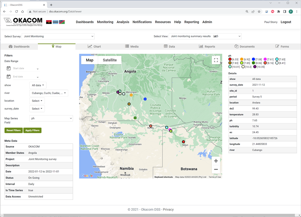
Most surveys have a spatial element, and the landing page for a survey is the Map page. Spatial data related to the survey is displayed and may be themed.
|
Monitoring : Map Names |
Monitoring: Map Explanation |
|
Select Survey |
Select the survey of interest |
|
Select View |
Select the view of interest |
|
Filters |
The filters for a survey are set up dynamically on the administration section and will vary according to the survey and the view. There will always be a date range filter if there is a date in the underlying data. The example illustrated is for joint monitoring of invertebrates, undertaken as part of a water quality analysis and there are filters for River and location (site). |
|
Map Series Fields |
Maps can be themed by more than one variable, and the visible theme is selected from the Map series field drop down. In this case the monitoring stations are themed by the river on which they are located |
|
Map layers |
As part of the set up of a view, map layers can be added. This view shows the Cubango-Okavango Basin and the perennial rivers. |
Created with the Personal Edition of HelpNDoc: Easily create Qt Help files